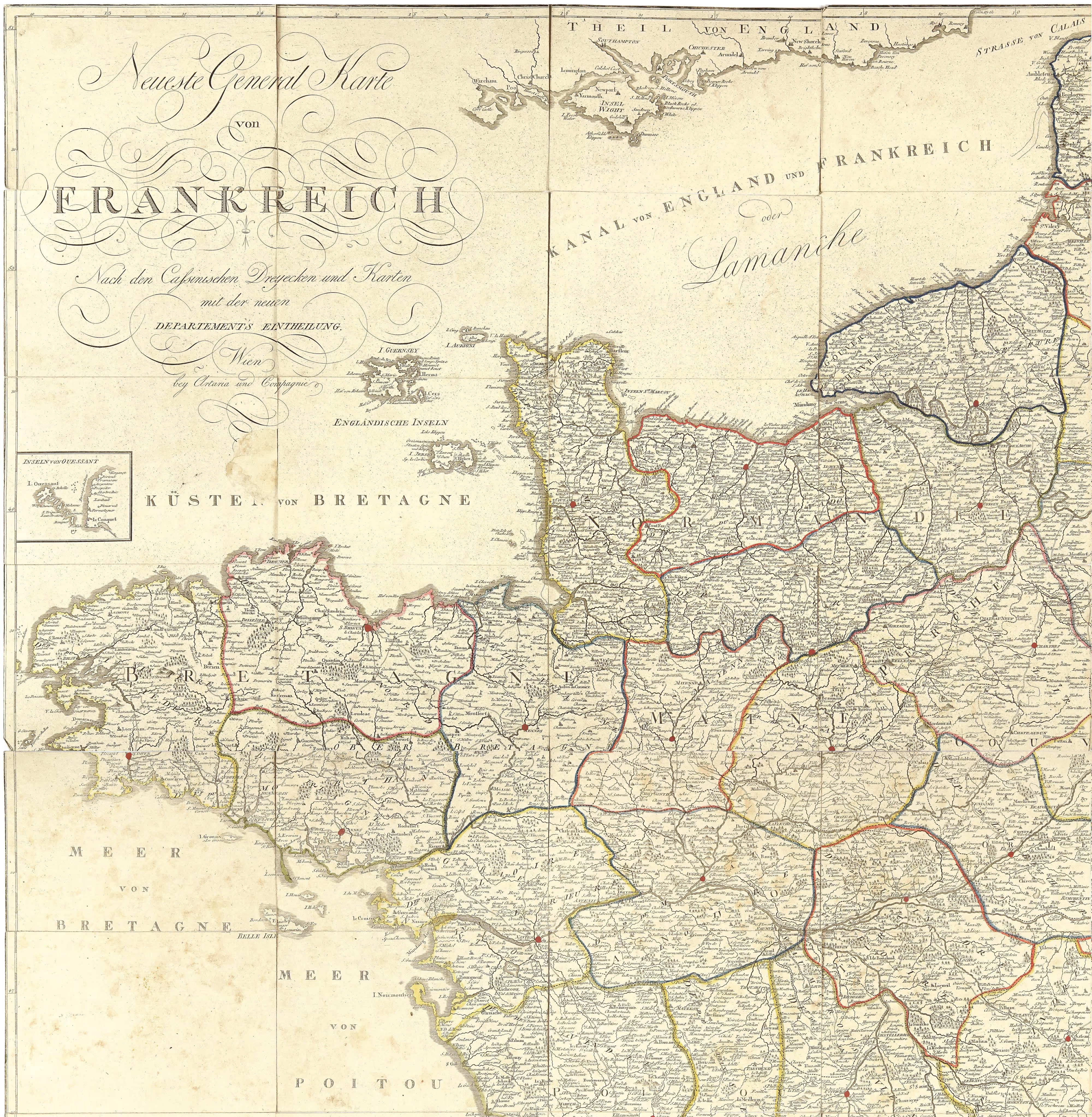


The Neuste General-Karte von Frankreich, published by Artaria in Vienna at the beginning of the 19th century, is a remarkable cartographic achievement that reflects both the political and geographical transformations of France during the Napoleonic era. Based on Cassini’s triangulation and the latest maps of the period, this work captures an extraordinary level of detail, meticulously documenting every town, village, and settlement across the country.
What makes this map particularly impressive is its sheer scale. When all segments are assembled, the final image measures an astounding 146.0 × 150.0 cm, making it an exceptionally large and detailed representation of France. The precise delineation of departments, marked with finely colored borders, showcases the newly implemented administrative divisions introduced after the French Revolution. These reforms replaced the old provincial boundaries with departments, a system still in use today. This restructuring was part of a broader effort to centralize governance and streamline administration, ensuring that local identities did not overshadow national unity.
A key element in the accuracy of this map is its foundation in Cassini’s triangulation, a groundbreaking cartographic method developed by the Cassini family during the 18th century. This work resulted in the first general map of France based on precise measurements rather than approximations. The Cassini project, which spanned over fifty years and involved four generations of the family, marked a major technical innovation in cartography. It was the first map based on geodetic triangulation, a technique that used a network of interconnected triangles to ensure exceptional accuracy.
The early 19th century was a period of immense change in France. Napoleon Bonaparte's rule had reshaped the country's territorial organization, legal systems, and infrastructure. Maps like this one were not just tools for navigation or governance but also instruments of power, reinforcing the state's control and modernization efforts. Artaria, a prestigious Viennese publishing house known for its high-quality cartographic productions, ensured that this map adhered to the highest standards of precision and craftsmanship.
Beyond its historical significance, the Neuste General-Karte von Frankreich remains a valuable artifact for historians and collectors. The clarity with which it renders even the smallest settlements speaks to the depth of knowledge available at the time and the importance placed on geographical accuracy. This map stands as a testament to both the scientific advancements in cartography and the geopolitical realities of early 19th-century Europe.
Cut into 96 individual segments that can be assembled into the complete map. Good to very good condition overall with few minor imperfections that can be expected with the age.
Interested in buying this map?
We can ship worldwide! Ask for a shipping quote or let us know if you are considering buying this map.
Interested in the price of this map?
Ask us in the form below. We can ship worldwide!
Want to be notified when it becomes available again?Leave us your e-mail below and we will let you know.


