By clicking “Accept All Cookies”, you agree to the storing of cookies on your device to enhance site navigation, analyze site usage, and assist in our marketing efforts. View our Privacy Policy for more information.
No items found.
No items found.
Atlases

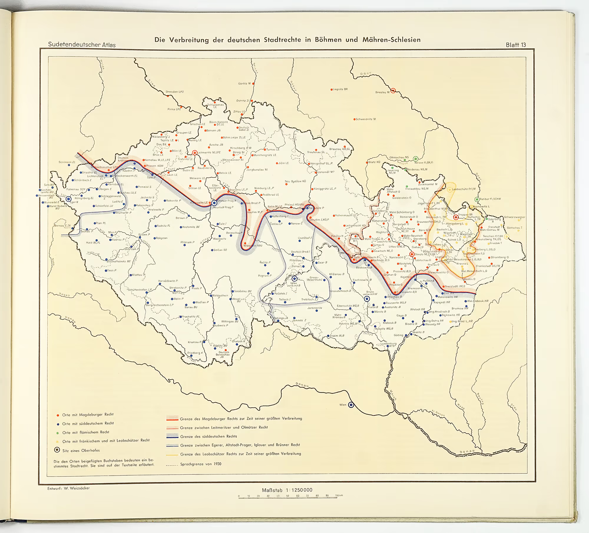
Sudetendeutscher Atlas

1954
E. Bachmann, A. Hammerschmidt, K. Oberdorfer, H. Rashchofer, E. Schwarz, W. Weizsäcker, E. Meyen
Verlag der Arbeitsgemeinschaft zur Wahrung sudetendeutscher Interessen

Full title

This "national atlas of the Sudeten Germans"  was supposed to serve as a documentary evidence concerning the Sudeten German ethnic group (the german speaking people which historically occupied the peripheral area of Bohemia, Silesia and southern Moravia which make the todays Czechia) and is the result of the combined efforts of Sudeten German historians, geographers, jurists, philologists, historians of art and political economists, aiming to testify to the economic and cultural achievements. 'Sudeten German Atlas' shows the Sudeten area prior to the expulsion of the Sudeten Germans in 1945-46, which was the result of the Czechoslovakian president Beneš's decrees. The expulsions were carried out by order of local authorities, mostly by groups of armed volunteers. However, in some cases it was initiated or pursued with the assistance of the regular army.Several thousand died violently during the expulsion and more died from hunger and illness as a consequence

The atlas conists of 26 maps of the Sudeten lands in Czech Republic prior to 1945 and 2 map of Germany, showing the distribution of Sudeten Germans after their expulsion from the Czech lands. The maps are accompanied by an explanatory text (sometimes augmented with statistical data) in French, German and English. One of the sources for the statistical maps was the Atlas Republiky Československé, the first Czechoslovakian national atlas from 1935.

Condition

Very good condition externally and internally, virtually no signs of use and no damages except slightly rubbed corners of the cover.

Maps
28 maps
Width × Height
46,5 x 41,5
cm
Total map area
5.4
m2
Weight
kg
Price:
170
 €
Ask for price
Sold
Leave us your email below and we will let you now when it becomes available again.

Interested in buying this atlas?
We can ship worldwide! Ask for a shipping quote or let us know if you are considering buying this atlas. We can send you more photos or answer any questions.

By submitting this form, you agree to be bound by Atlaseum's Terms & Conditions and Privacy Policy.
Thank you!
Your submission has been sent! We will get back to you as soon as possible.
Oh no!
Something went wrong while submitting the form. Please try it again later.

Interested in the price of this atlas?
Ask us in the form below. We can ship worldwide!

By submitting this form, you agree to be bound by Atlaseum's Terms & Conditions and Privacy Policy.
Thank you!
Your submission has been sent! We will get back to you as soon as possible.
Oh no!
Something went wrong while submitting the form. Please try it again later.

Want to get this atlas?Give us your e-mail and we will let you know, once the atlas becomes available again.

By submitting this form, you agree to be bound by Atlaseum's Terms & Conditions and Privacy Policy.
Thank you!
Your submission has been sent! We will notify you when this atlas becomes available again.
Oh no!
Something went wrong while submitting the form. Please try it again later.

Related atlases: