


The 'Atlas of Ice Conditions in the North Atlantic Ocean' is a remarkable cartographic work that provides a detailed examination of ice conditions in the North Atlantic and both polar regions. Published by the German Hydrographic Institute, this atlas is the product of years of meticulous research, with its origins tracing back to wartime efforts at the German Maritime Observatory.
One of the most appealing aspects of this atlas is its historical significance. The first complete edition, along with its printing plates, was destroyed in an air raid in 1944. However, the surviving materials were painstakingly revised and expanded between 1945 and 1947, ensuring that this volume not only preserved critical scientific data but also reflected the latest postwar developments in ice mapping.
The creation of such an atlas during World War II was likely motivated by both military and economic considerations. Detailed knowledge of ice conditions was crucial for Germany’s naval strategy, particularly for U-boat operations in the North Atlantic. The Arctic played a key role in the war, with German forces seeking to disrupt Allied convoys supplying the Soviet Union via the Murmansk route. Understanding ice conditions would have helped in planning submarine routes, avoiding hazards, and predicting the movements of enemy vessels.
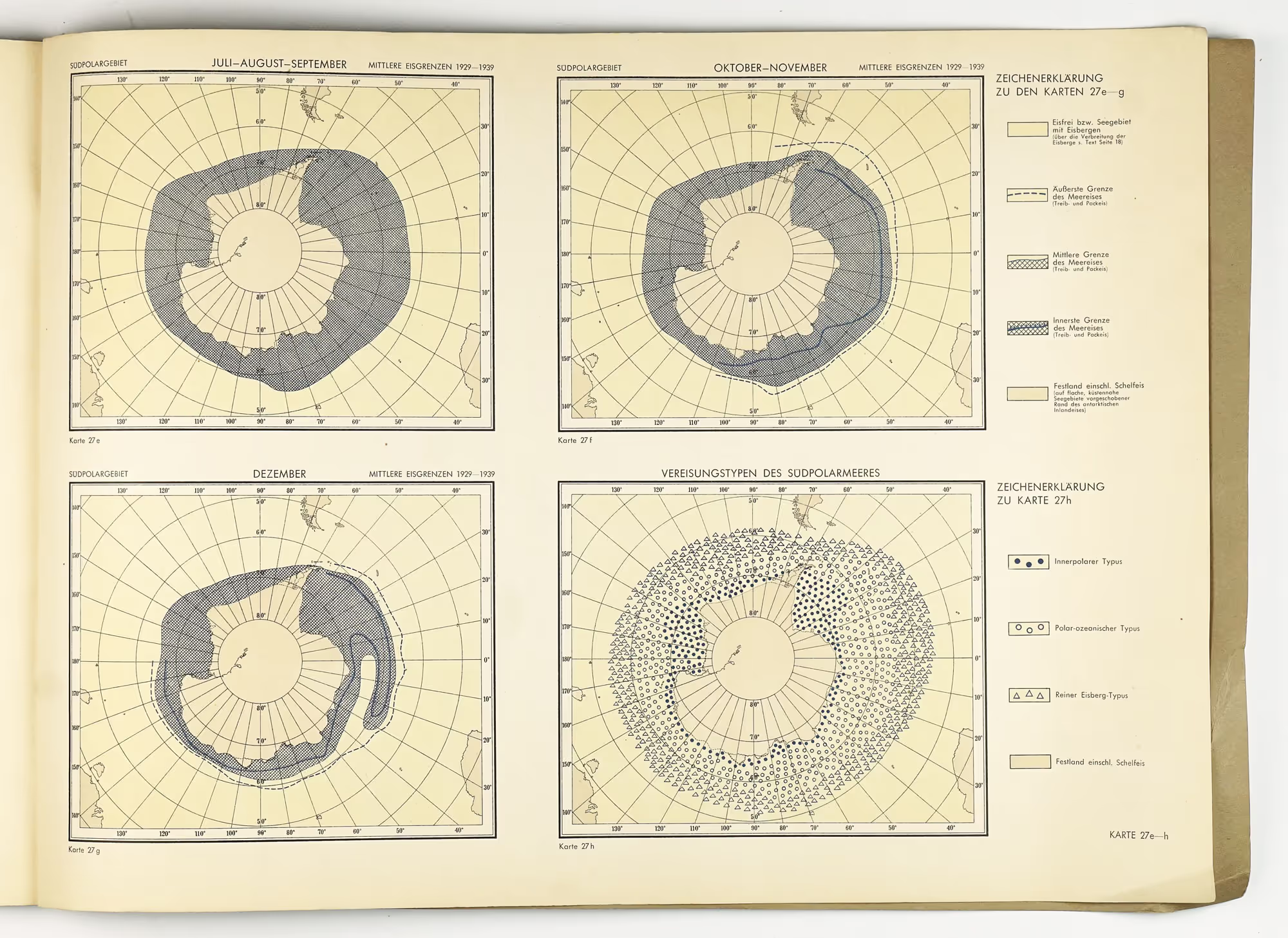
The author of the text also underscores the importance of the cryosphere as a distinct and dynamic component of Earth's system. Unlike the lithosphere, atmosphere, and hydrosphere, which are more continuously present across the planet, ice cover is highly variable, experiencing significant seasonal and geographic fluctuations. Sea ice, in particular, plays a crucial role in shaping maritime conditions, fluctuating between winter and summer with remarkable differences in extent and thickness. While winter sea ice can extend across vast areas, forming a temporary but significant barrier to navigation, multi-year polar ice remains present year-round, growing thicker and more compact over time.
One of the major breakthroughs in ice research during the war was the use of aerial reconnaissance to study sea ice conditions. Before the 1940s, scientific understanding of ice distribution was limited to coastal observations and sporadic ship reports. However, German ice reconnaissance flights, beginning in 1940, revealed that sea ice extended far beyond previously assumed limits, particularly in severe winters such as 1941/42 and 1946/47. These flights allowed for more precise mapping of ice formation, movement, and transformation, providing valuable insights into the rapid and unpredictable changes caused by temperature shifts, wind, precipitation, and ocean currents. This research was particularly critical in highly dynamic areas like the Baltic Sea, where ice conditions varied dramatically from year to year.
Beyond military and scientific applications, Germany had long-term interests in Arctic exploration and resource exploitation. The Nazis saw the Arctic as a potential hub for future economic expansion, including access to fisheries and natural resources. Additionally, meteorological stations in Greenland and other remote polar areas played a role in wartime weather forecasting, which was critical for both naval and aerial operations. The scientific expertise embedded in this atlas reflects Germany’s broader strategic interest in polar research, a field that continued to evolve during and after the war.
The atlas itself is a testament to the precision and dedication of the ice service of the German Hydrographic Institute and especially Prof. Dr. J. Büdel. The maps provide an invaluable resource for navigators, researchers, and nowadays historians alike, offering insight into ice distribution patterns that influenced maritime routes and polar exploration.
For collectors, historians of polar research, and maritime professionals, this atlas is both a fascinating artifact and a practical reference. It bridges the gap between past and present, showcasing the challenges and advancements in understanding ice conditions in crucial maritime regions.

.avif)

